Created in 1960 to protect the southernmost forests by the Beagle Channel, Tierra del Fuego National Park covers an area of 63,000 hectares.
Tierra del Fuego National Park can be reached by taking National Route 3 from Ushuaia after circling Mount Susana and going along the Pipo River Valley. At Lapataia Bay, a road sign indicates the end of this route and the distance to its opposite extreme in the City of La Quiaca, on the border with neighboring Bolivia.
Mountain ranges cross the park dividing it into valleys which are really difficult to reach. Un other Andean-Patagonian parks, it has forests by the seashore, six kilometers along the Beagle Channel: Lapataia Bay, meaning ‘woody bay’‘bay of wood’ in the Yámana tongue.
There are many coves and points shaping beaches and cliffs, creating a perfect shelter for sea fauna.
There are many coves and points shaping beaches and cliffs, creating a perfect shelter for sea fauna.
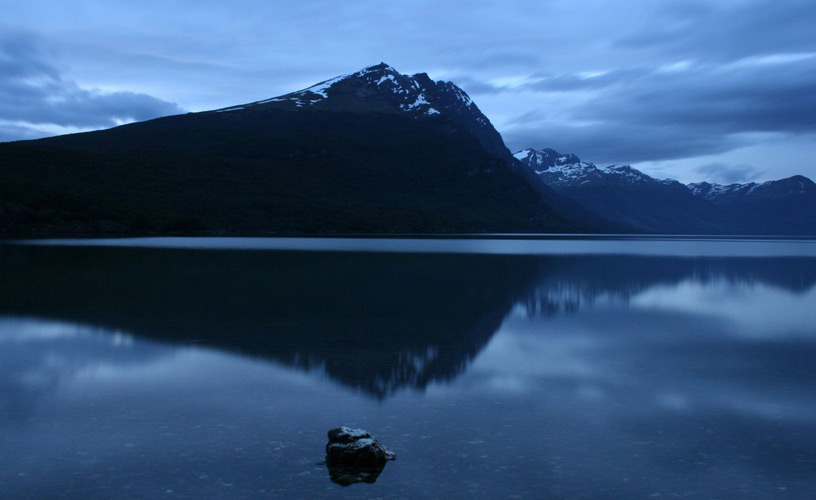
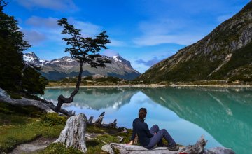
Lake Roca, opposite Mounts Condor and Guanaco, lies in the south of the park. It flows into the sea at Lapataia Bay through Lapataia River, a short turbulent watercourse. This practically virgin, especially protected area in the north of the park encompasses the central part of Lake Fagnano.
The forests in Tierra del Fuego National Park are no other. Peat bogs, made up of a dense layer of moss and other organic matter, are plentiful in the island ecosystem besides the rest of the flora with native species such as ñire, lenga , Magellan’s beech and cherry trees.
Old man’s beard hanging from tree branches is a familiar sight, as is reddish moss. Flowers can be enjoyed throughout the year be they the eye-catching red flowers of the Chilean firetree, crowberriesyellow violets.
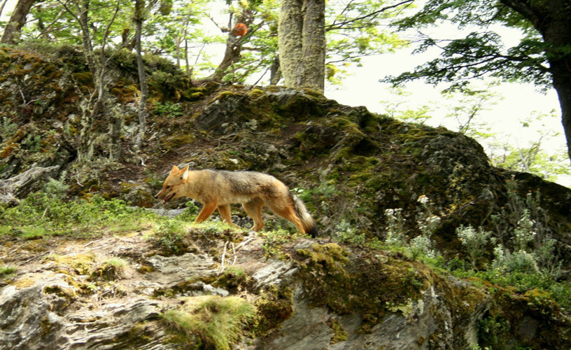
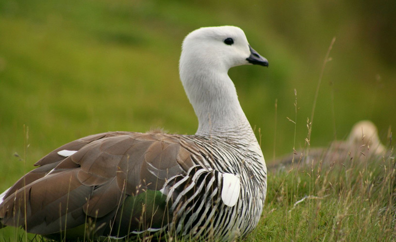
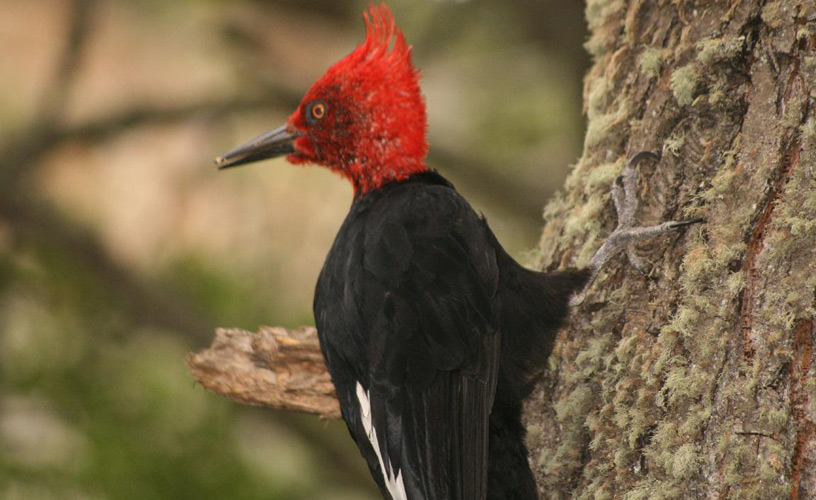
Numerous birds inhabit the forests such as the Magellan woodpecker, the Magellan goose and the Austral conure. Among the mammals, red and gray fox, guanacos, sea otters and beavers (an exotic species).
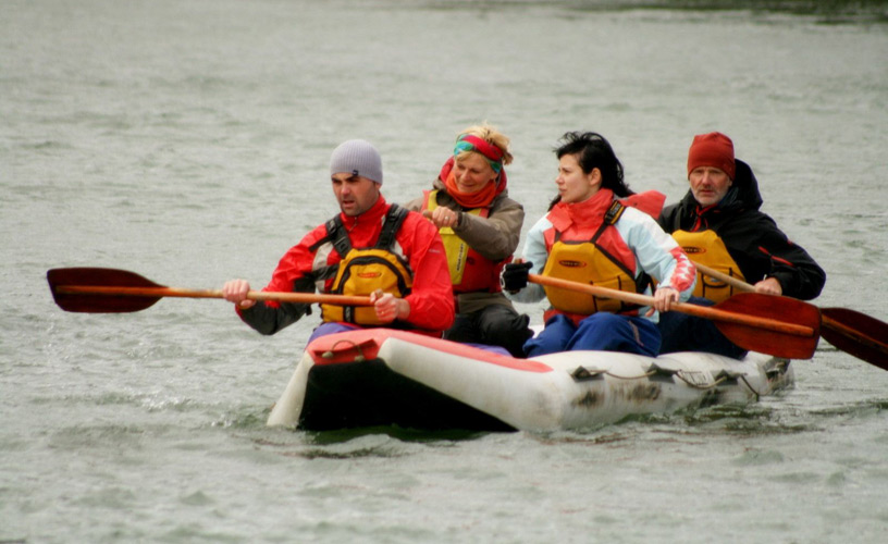
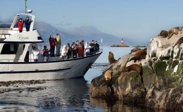
Many marine invertebrates such as mussels, limpets and winkles as well as much appreciated crustaceans such as spider crabs can be found among the rocks on the coast of the Beagle Channel. The puyén and peladilla, as well as the sea bass are native fish.
The park holds testimonies of the people who inhabited Tierra del Fuego before the arrival of the white man: the Selk’namOnas, the HaushManek’enk, the Alakaluf and the YámanaYahganes. Near the coast there are archeological sites with ‘conchales’‘concheros’ (accumulations of shells), piles of mollusk valves and animal remains of the Yámana staple diet.
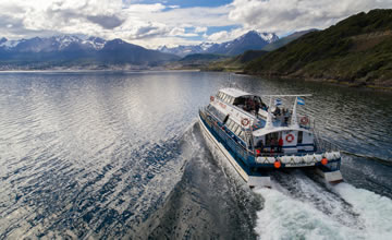
There are two ways of reaching the Beagle Channel: a two-kilometer road to Bahía Ensenada, from where Isla Redonda (Round Island) can be seenalong Bahía Lapataia until the end of Route 3.
The bay, the cove, Isla Redonda and Canal Estorbo, Les Eclaireus Lighthouse and Ushuaia can all be admired from a catamaran that leaves from Puerto Arias. Bridges Islands (De los Pájaros and De los Lobos – Birds and Sea Lions Isles) can also be reached.
Should you continue by land, after crossing River Lapataia, Ovando and Cormoranes archipelago you will reach the Interpretation Center and the Yámana ‘conchero’ (accumulation of shells) from where a great variety of sea birds as well as isolated groups of sea lions and porpoise can easily be spotted.
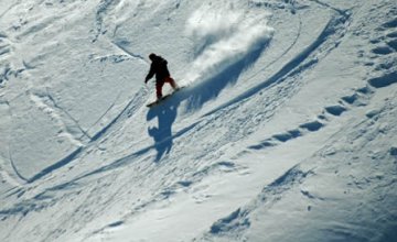
The park offers opportunities for trekking lovers. Two interpretive trails can be accessed from the Interpretation Centre: Laguna Negra (Black Pond), which traverses a peat bog and Sendero de los Castores (Beaver Trail). Visitors who prefer a longer hike can set off along a four-kilometer trail leading to milestone XXIV, which marks the border with Chile,a two-kilometer trail to Pampa Alta, from where they will enjoy a panoramic view of the Beagle Channel, Yendegaia Bay in Chile, Isla Redonda and Ushuaia and Ensenada Bay.
Tierra del Fuego National Park is a must see destination for visitors to the City of Ushuaia, not only because of the variety of activities it offers, but for its amazing biodiversity as well.