Leaving from the City of Salta, visitors may tour around one of the most impressive circuits in the Republic of Argentina as they visit the legendary Calchaquí Valleys through a road that leads to amazement without rest.
In order to visit the Calchaquí Valleys and appreciate their beautiful sceneries and the quaint villages from the early XVIII century nestled in their geography, visitors must travel a total distance of 520 kilometers through three main roads, namely Provincial Route 33 and National Routes 40 and 68.
From the very beginning, fascination takes hold of travelers as they enter the San Fernando de Escoipe Ravine. Surrounded by mountains and bordered by Provincial Route 33, it sets the start of adventure.
The local vegetation is typical of the montane rain forest, with the presence of hydrophile and xerofile plants. Ancient laurels, willows, walnuts, peachtrees, poplars and some conifers are always present in the area.
From the vehicle, visitors may see terraces or platforms planted with corn, oats, peas or beans on the slopes of the hills located to both sides of the road.
The dirt road is crossed by meltdown spring creeks on their way down from the heights, but they do not represent any kind of obstacle for travelers. The Agua Negra Ravine and the Malcante River escort visitors on this stage of the tour.
At the end of the Escoipe Ravine, the winding "Cuesta del Obispo" (Bishop's Slope) begins. It got its name from Monsignor Cortázar, the maximum ecclesiastical authority in Salta, who was traveling from Salta to Cachi back in 1622 and spent the night at this spot lying at 3,400 m.a.s.l.
At the top of the slope, known as "Piedra del Molino" (Millstone), lies a chapel raised to honor the Archangel Raphael, "Patron Saint of Travelers". This spot features an unforgettable view of the endless slope, which gets mingled with the granite formation of feldspar, mica and quartz contained in the area.
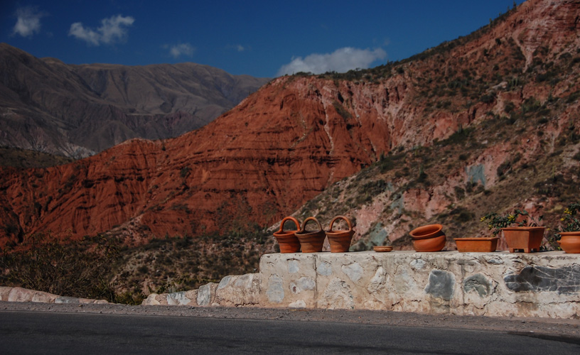
Driving on, there appears a place which faithfully honors its name: the "Enchanted Valley", a dreamed-of place with red soil and green grass where the huge rocks and the uneven terrain astonish the most daring visitors, who are used to being delighted by natural wonders.
Heading for Los Cardones National Park
After resting the sight on such natural masterpiece, travelers begin their way down a depression of the heights. The road leads to Cachi Pampa – "salt pampa” in the Cacán tongue.
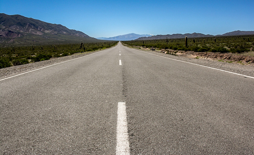
After a few kilometers, the Tin Tin Straight is entered. Fully paved, this 12-kilometer-long stretch displays the impressive snow-capped Curacatao summits in the distance. The tour always features the characteristics of the scenery, totally worth beholding.
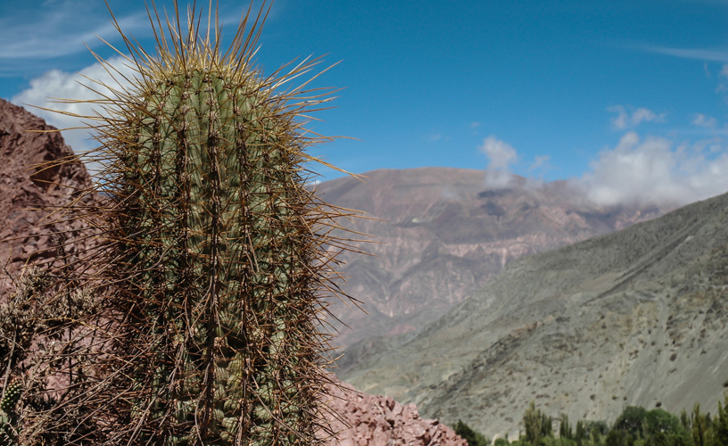
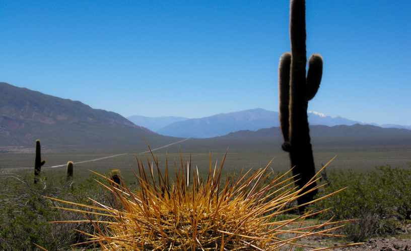
Los Cardones National Park welcomes and amazes visitors with the thousands of cardons it contains. Laid out as mastic trees all around the land, this place becomes almost incomprehensible. It is admirable to watch the various shapes acquired by the cactus pasacana. Some specimens can reach up to 6 meters of height and, bearing in mind that they grow 5 cm per year, it is easy to guess their age.
The area where the cardons are located features an alternative Andean basalt relief exposed to a metamorphic action as a consequence of temperature extremes -0º thru 35º C. As a result, the soil appears to be cracked. Plants such as black jarillas with yellow cholongas are the only company of cardons before the desolate landscape.
Cachi: “Town of Salt”
The Tin Tin Straight bends frantically to the left. The elevations known as “Cumbres del Libertador” (The Liberator's Summits) and “Nevado de Cachi” (Cachi Snowcapped Mountains) -reaching 6720 m.a.s.l- are observed in the background. Thus, visitors find themselves in the Calchaquí Valleys strictly speaking, once crossed by Inca Atahualpa, Juan Calchaquí, and Spaniards such as Don Diego de Almagro in 1536. That is an exciting moment. Going past Payogasta, the road gets to enigmatic and historical Route 40, one of the most exceptional roads in Argentina. To both sides, the silent Calchaquí Valleys seem to observe the audacious expedition members.
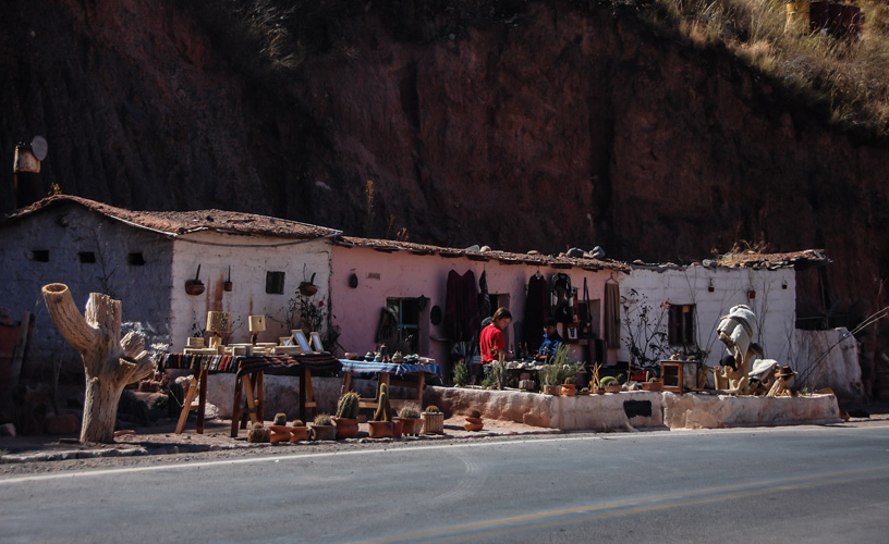
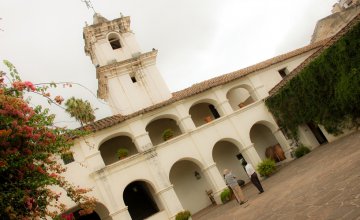
After a few kilometers, the town of Cachi opens its gates to show its simple beauty. It is a good moment to make a stop, rest for a while and tour around the purely colonial district.
Cachi means “salt” in the Quechua or Cacán tongue, and it was given such a name by the local natives, who had mistaken the summit of Nevado for a big salt deposit. When touring around the village, visitors can appreciate the politeness of the people, who appear to be in tune with the architectural surroundings.
The cobbled streets, the whitish buildings, the parish and the well-known Archeology Museum were built around the main square in the mid XVIII century and invite visitors to behold and admire their features.
After a delicious regional meal, made up by tamales, locro, humita or spicy chicken accompanied with a good glass of wine (only one because the excursion must go on), the tour around the valleys continues surprising travelers.
Route 40 passes by several villages scattered along the valleys and making up this Calchaquí scenery. At the village of Seclantás, it is very likely to find its inhabitants working on the looms, making real handicrafts such as ponchos, belts and sashes. If visitors have some time to spare, we recommend that they make a stop at don Alfredo Guzmán's house. This man, also known as "el Tero” (the Lapwing), is glad to tell travelers some of his personal secrets when it comes to weaving threads in the loom.
Another singular attraction in this town is its church, built in 1835, and protected by Del Carmen Virgin.
Farther ahead lies San Pedro Nolasco de los Molinos, another district founded in the mid XVIII century. It is made up by adobe houses with porticos and galleries. Its church follows the Cuzco style and was built with quartz. San Pedro Nolasco de los Molinos and Del Rosario Virgin are its Patron Saints.
During the ride along mysterious Route 40, travelers may observe several workers from “La Angostura” and “La Arcaídia” estancias digging the weeds from the onion nurseries or keeping an eye on the goats.
Suddenly, a kind of oasis amidst the Calchaquí Valleys shows the way to “Angastaco”, which in the Cacán native language means “people of the high pool". The stanza written by Manuel J. Castillo and displayed by the welcoming sign post at the entrance of town indicates the politeness of the local dwellers: “Walker reaching this sandy village, let Angastaco offer you its fortune, its friendship and its wine, which you shall drink gladly while you step on the white heart of the moon.”
Lands of the Torrontés
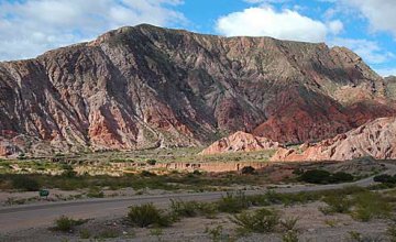
Following the zigzagging road, the local topography begins to show majestic rock formations, such as Quebrada de las Flechas (the Arrows' Ravine) or Piedra Pintada (Painted Rock).
After some kilometers, the road goes past San Carlos, once considered the "granary of Upper Peru" when the Company of Jesus began to settle down in the area. It is important to point out that its church was built in the Cuzco style in 1760.
During the tour, the landscape becomes more and more intense. The Tolombón, San Antonio and Acochuya estates prepare the travelers' senses for the moment they reach Cafayate.
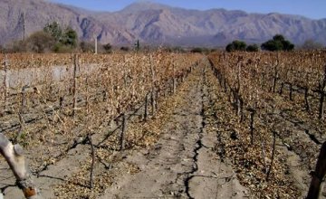
Cafayate is bordered by rivers, sandhills and vineyards where the torrontés grape is grown in a worldwide known variety used to make wines with delicious taste, body and color.
Once there, visitors may stay at some local hotel and get ready for the following morning. Before leaving Cafayate, the wineries that make up the Route of Wine are a must. They unveil the most select secrets of winemaking and offer visitors the chance to taste the most exquisite productions in town.
The architectural style in town is a cross between colonial and Baroque from the late XIX century, as evidenced by its five-aisle cathedral.
The tour around the Calchaquí Valleys starts once again, this time towards the starting point: the City of Salta.
The Final Turn
Leaving Cafayate, visitors must take fully paved National Route 68, which is in excellent condition. The tour continues through the Cafayate Ravine, which displays colorful rock formations offering an unprecedented show.
Imagination plays an essential role in this stretch of the tour, as the clayish sandstones are "molded" by the wind and river erossion and they adopt well-known shapes. Thus, the road passes by "the Boat Marina”, “the Rabbit”, “the Obelisk”, “the Friar”, “the Amphitheater” and “the Devil's Throat”, to name some of the sculptures that charm visitors.
On the way, the Santa María River is crossed. This is the only water course in the country flowing northwards due to the geophysical and orographic comformation of the region. This river appears when it joins the Calchaquí River, and it adopts the name of Río de las Conchas (River of the Shells), so-called after the ravine that surrounds it, where there is a strong presence of sea fossils.
After crossing the town of Alemania, the road leads to the famous Valley of Lerma, which reveals the proximity of the City of Salta. This fertile valley occupies a surface of 120 kilometers of length and 40 kilometers of width, with thick mountain ranges, fields sown with tobacco and featuring excellent weather almost all through the year.
The Valley of Lerma features a drainage basin that causes part of the volume of its rivers to empty into the Bermejo River basin, whereas the other part is accumulated in the Cabra Corral Dam to continue its course along the Juramento River.
The last towns greet travelers. With their colonial architecture, their handicrafts, their music and their regional poetry, La Viña, Ampascachi, Coronel Moldes and El Carril bid their farewell to tourists who return to the City of Salta feeling completely amazed at the experiences enjoyed during the tour around the vast territory of the Calchaquí Valleys.