Río Gallegos
 Río Gallegos - Jorge González
The southernmost continental urban settlement on the Atlantic Patagonian coast is the City of Río Gallegos. It is the capital of the Province of Santa Cruz and a tourist distribution center towards the island of Tierra del Fuego and the mountain range that stands between this country and the Republic of Chile.
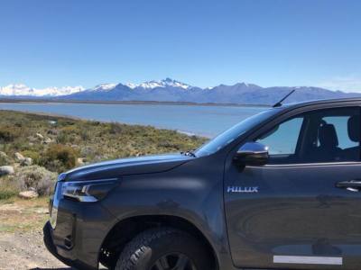
Río Gallegos rests on the vast Patagonian high plateau, crossed by transversal valleys running from West to East, and it lies on the shores of the homonymous river. At this spot, the land slopes down to the Argentinian Sea in a terraced shape ending at the port located a shortly before getting to its mouth.
The climate at Río Gallegos is cold and dry. Temperatures drop below zero in the winter. Winds are strong in the spring and mild in the summer, when daylight lasts longer than usual.
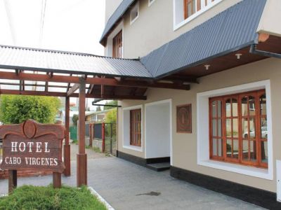
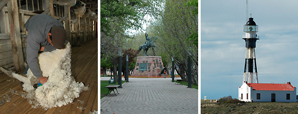
Tourism has increased as a result of emblematic outings that lead visitors away from the city towards the penguin colonies and the lighthouse at Cape Vírgenes, Punta Loyola or the Blue Lagoon, in the crater of the volcano bearing the same name. Besides, it is possible to see the lifestyle at the local estancias, where sheep husbandry is intensively practiced. In the city, the museums illustrate the hundred-year-old life of Río Gallegos and its pioneers.
The tourist sights in the city have led to a significant progress as far as accessibility for people with reduced mobility is concerned. Thus, architectural barriers have been minimized so as to provide this part of the population everything necessary to carry out most activities properly.
Río Gallegos fishing port is extremely important for the economy of Patagonia. It is the way through which sheep skin, wool and frozen meat produced at meat processing plants are exported.
At the port, the variation of tides is so ample that ships must anchor for several hours at Punta Loyola until the conditions are met for them to enter and moor at the docks. Watching the boats waiting is an attraction itself.
The Penitente and Rubens Rivers come from Chilean territory and join together into the Gallegos River, whose irregular banks feature cliffs and beaches. Quiet waters and strong currents follow one another up to the moment in which the waters are emptied into the Atlantic. This creates excellent areas for angling, where highly coveted brown and fontinalis trout specimens are caught. Specialized guides provide information for anglers regarding regulations in force, banned areas and good fishing environments.
Río Gallegos lies on National Route 3, at 51º 38 south latitude and 69º 12 west longitude, 2,636 kilometers away from Buenos Aires. Its international airport offers a wide range of air communications including cities from Argentina and Chile, Antarctica and the Malvinas Islands. It used to be a supplies stop for the first transpolar flights to New Zealand and Australia.
It is well known that its gravel roads, strong winds and harsh climate make it essential to take precautions when it comes to traveling around the area. Instead, its unspoiled sceneries, its native fauna and its people well deserve a visit with a photographic camera ready to shoot.