A trip across the core of the mountain. We went on a conventional excursion to the Atuel River Canyon and learnt everything about its formation. We visited the El Nihuil Dyke.
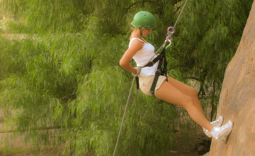
Speaking about San Rafael implies, among other attractions, speaking about the dazzling canyon formed by the Atuel River. This attractive place, where many adventure sports, such as river rafting, hiking and mountain biking are practiced, stands very close to the city and may be discovered by any tourist visiting the area.
In our brief visit to the city, we did not want to miss this natural attraction. We hired a conventional excursion and let ourselves be carried away through the enigmatic region about which we had heard so much. The sky was cloudless. The bright sunshine and no wind guaranteed that we would get the best pictures of this place.
We left San Rafael and the Mariano Moreno Park behind. The young guide told us part of the local history. The place was colonized by the French in the early 1900s. We traveled along Provincial Route 143, across the Cuadro Venegas district and did not take long to see thousands of hectares teeming with fruit trees, among which the peach trees, plum trees, grapevines, olive trees and walnut trees stood out.
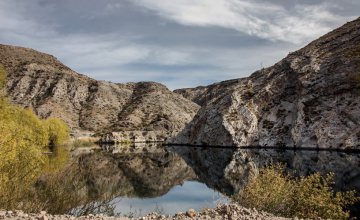
The Nihuil Mirror
After a few kilometers, we noticed how the vegetation around would change into desert and steppe vegetation. We were heading West towards the impressive silhouette of the Andes Mountain Range. In the Cuesta de los Terneros area, we learnt that its yellowish shades are the result of the rich presence of sulfur oxide, its green color is due to the copper oxid, whereas the reddish shades correspond to the iron oxide. We climbed up to 1,100 masl and stopped at the San Francisco de Asís vantage point so as to appreciate the endless panoramic sight formed by the Los Huarpes depression.
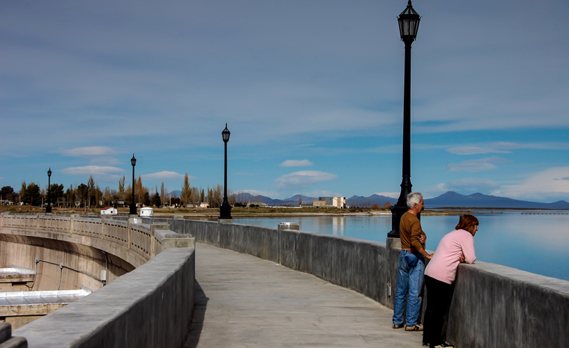
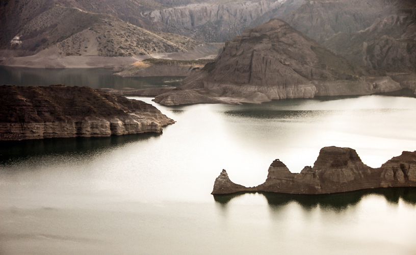
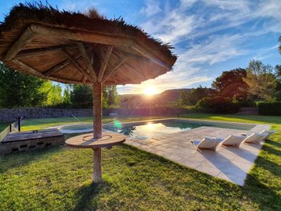
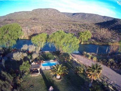
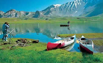
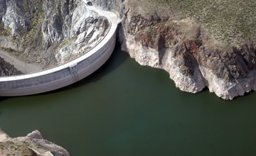
We continued along the great depression and, after a few kilometers, we reached Lake Nihuil. This water mirror lies 30 kilometers from the Atuel River source, has a 9,600-hectare surface and an approximate depth of 20 meters. Our guide explained that Nihuil-co has two meanings in the Mapuche language: it may mean “where the thrush rests” or “the tigers' roar”. There is a small town bearing the same name as the reservoir close to the coastline, which lodges about 800 permanent inhabitants. Furthermore, very beautiful weekend houses in various architectural styles may be observed on the lake shore.
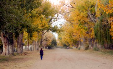
During the mandatory stop at El Nihuil to have lunch in one of the local restaurants, we resolved to tour the picturesque streets of the village. Silent and quiet, El Nihuil seems to have stopped in time. Some kids playing with a dog and a rusty “Cinzano” sign are some of the images I can recall from my visit to this place.
Amid Sighs and Moans
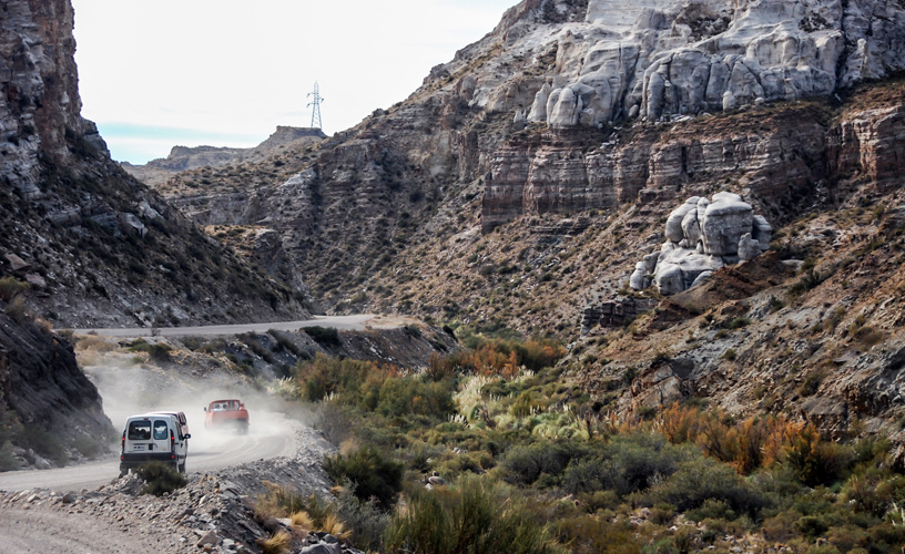
Our trip continued, this time into the Atuel Canyon with all the enthusiasm. We passed by some rock formations called Garganta del Diablo (The Devil's Throat) and Mirador del Cacique (Indian Chief Vantage Point). At this point, the paved road comes to an end and a rubble winding road starts.
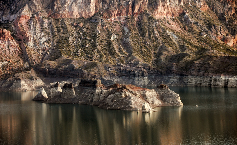
The great walls of the canyon began to gain more relevance as we advanced. The area we were crossing is also known as 500-million-year-old sierra pintada (painted mountain range). The erosion caused by the water and the wind gave shape to these formations. We let our imagination fly away and, even playing a little with our sight, we found several famous figures. Most of the canyon rocks are volcanic and date from the Paleozoic Age, although there is also a strong presence of magma and metamorphic rocks. It is incredible how much can be discovered with just looking at one of these huge walls. The black stripes from the Carboniferous period evidence sea sediments.
At 1,300 masl, we began to go down the very core of the canyon. This place is known as Cuesta de la Costurera (The Seamstress Slope), a place where sighs and moans are often heard, depending on where the passengers are sitting inside their vehicle, as the cornice road is quite narrow.
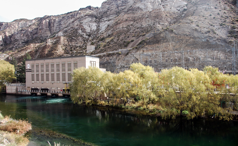
During the trip, we crossed several hydroelectrical dams, which form the Los Nihuiles group. It is important to point out that it is forbidden to get into the river in the stretches located between one dam and the next.
The Splendor of the Canyon and Its River
Farther ahead, we passed by the Negro Ravine, a formation known as “los toboganes” (the slides) and as the “paleta del pintor” (painter's palette), where sulfur oxide stands out.
Among the geo-shapes, we find the “elephant family” the “owl”, the “skull”, the “nun peregrination” and the attractive “wax museum”, among the most outstanding.
We made several stops in order to appreciate the rock formations that give shape to the canyon from a close distance.
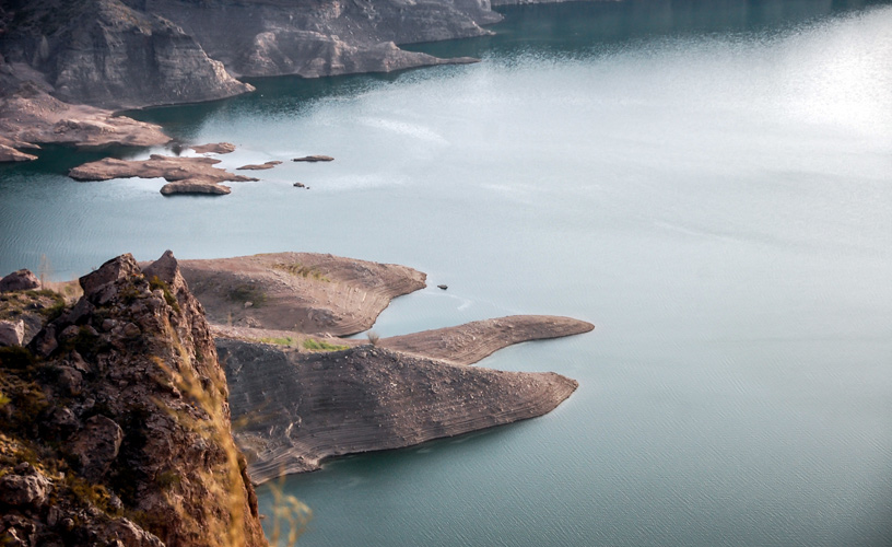
Before we could notice it, we arrived in the Valle Grande reservoir, where there is another beautiful 508-hectare water mirror which is 60 meters deep and is used for the practice of water sports and sport fishing. As the water level was low, we could see the famous “submarine” formed with rocks lying on its bed. We relaxed our sight and, once more, we had a break to behold the scenery.
The day was coming to an end and we continued along the isolated canyon for some more kilometers. We stopped at a local farmhouse to taste some homemade jams. We enjoyed the kindness and politeness of the owner. By then, we felt more than grateful for the nice moments we had just experienced.
We returned to civilization along the most direct road to San Rafael and, before it disappeared in the distance, we said good-bye to the Atuel Canyon making a promise to go back and enjoy a river rafting experience in its cold crystal-clear waters.